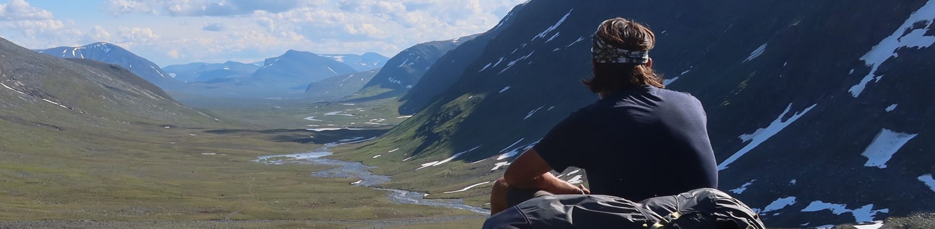

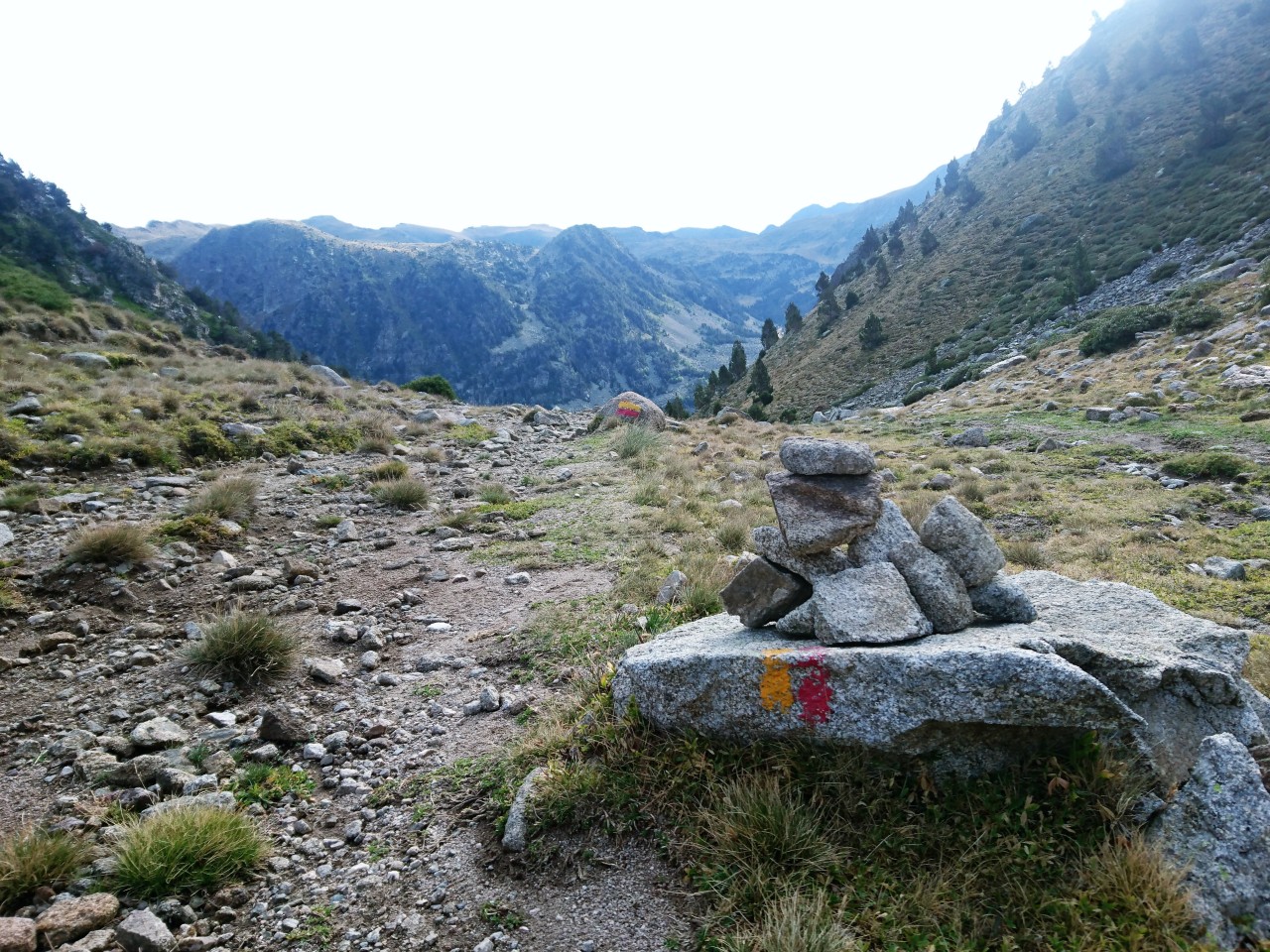
The yellow and red marking of the GRP trail seen from Pic Negre on day 1
The GRP (Grande Randonee Pays) is a hiking trail that circumnavigates the small state of Andorra in the Pyrenees. It is also called the LDP or long distance path. The markings along the way is red and yellow stripes. It is 120 kilometers long and has a total of 8290 meters of gained altitude. The trail is divided into seven stages from 12 to 20 km where each stage stops at one of the 29 Refugis or huts spread out over the mountains. Most are unguarded but all is of a high quality. You can also wild camp along the way if you so wish. We stayed in huts two nights and wild camped in the mountains on the other nights. To help you plan your hike there you can look at these websites.
Map of Andorras trails and Refugis

Henrik and me
My hiking buddy Henrik and I flew into Barcelona and rented a car to take us to Andorra, which is approximately a three hour drive. Along the way we picked up som gas for his stove at a Decathlon store near the airport and some alcohol for my stove, curiously enough bought at a gas station. Andorra is basically one long valley on the border between France and Spain. The main town is called Andorra La Vella. We arrived in the late afternoon in small southern town of Saint Julia de Loria close to where we had planned to start our hike the next day. We had booked a hotel room to stay in the first night. In the morning we had breakfast and ordered a taxi to take us to our start location. The official route starts in Aixovall, but the first part is along the main valley and didn’t look so interesting, so we changed that and started in Juberri instead.
Day one – Juberri to wild camp close to Refugi Perafita – Total ascent 1300 meters.
We exited the taxi in the small town of Juberri (1300 meters) and headed up through the very steep terrain towards the Pic Negre mountain passing the Refugi Roca de Pimes (2160 meters) along the way. The trail then moves along a dirt trail all the way to the Pic Negre or Black Mountain (2644 meters).

Sierra Designs new flex pack and Gossamer Gear carbon poles on top of Pic Negre
We passed a large group of hikers on a day trip coming the other way. They looked like locals on a Sunday hike. On the top we were joined by a young Spanish guy, who was also hiking the GRP. We exchanged greetings and communicated in poor Spanish/English and handsigns while showing eachother maps. He then took off and we followed him at a distance. Just before we made camp beyond the Refugio de Claror at a small lake. We waved to him and he waved back. We never saw him again on the route. From the top of the Pic Negre, we looked into the beautuful Claror valley.
Looking into the Claror valley from Pic Negre
The descent was very nice and scenic. We passed a hut, and a few kilometers beyond we decided to wild camp right next to a small lake where we could see a couple of horses graze in the hills. The evening went by fast and it started getting colder, as we were still at around 2100 meters altitude so we hit the sleeping bags early.

Wild camp besides small lake on the first night
Day two – Wild camp to Refugi Pla des les Pedres – Total ascent 1000 meters.
We began the day with hiking past the Refugi Perafita, where we ate breakfast. After the Refugi the trail began a steep ascent up over the pass of Collada de la Maina before descending again and hitting the GR 11 trail that would take us up towards the newly opened and refurbished Refugi de I’llia, which is a huge manned Refugi at the banks of the lake with the same name.
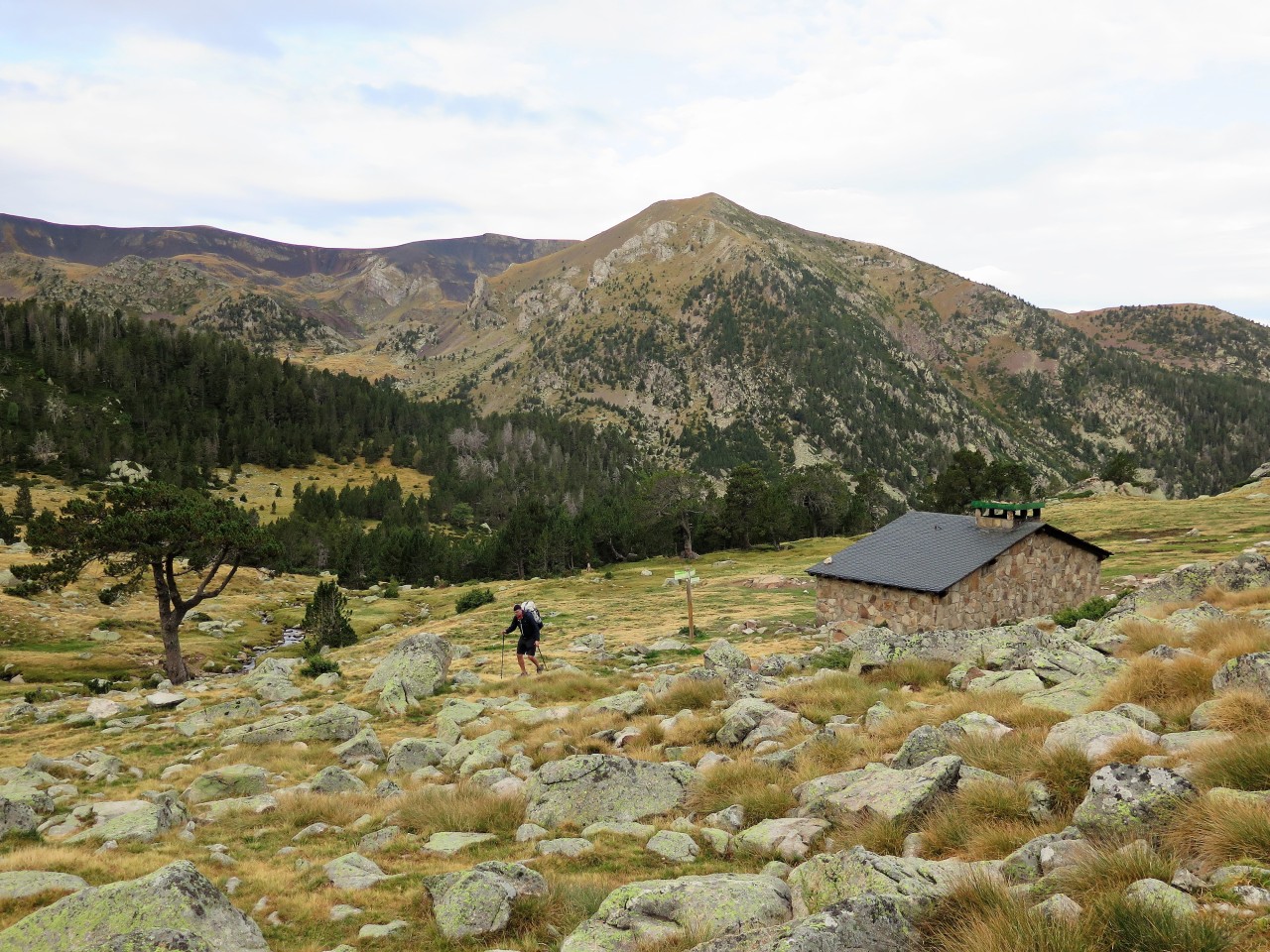
Passing Refugi Perafita with Pic Negre all the way in the background
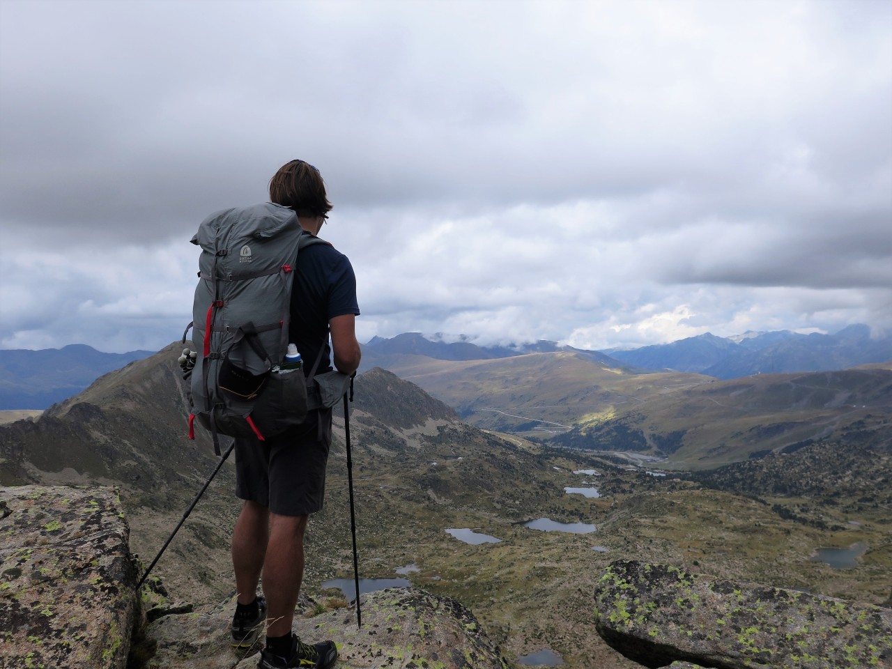
From the lake side you can see up towards the Pic dels Pessons at 2864 meters. The climb up is very tough but rewards you with a great scenic view down and accross the Estany Pessons lakes and also across into France and in the west you can spy the Pic de Comapedrosa, where we will reach on day five.

Small typical Pyrenean mountain hut used by the herders bearing the GR 7 and 11 markings
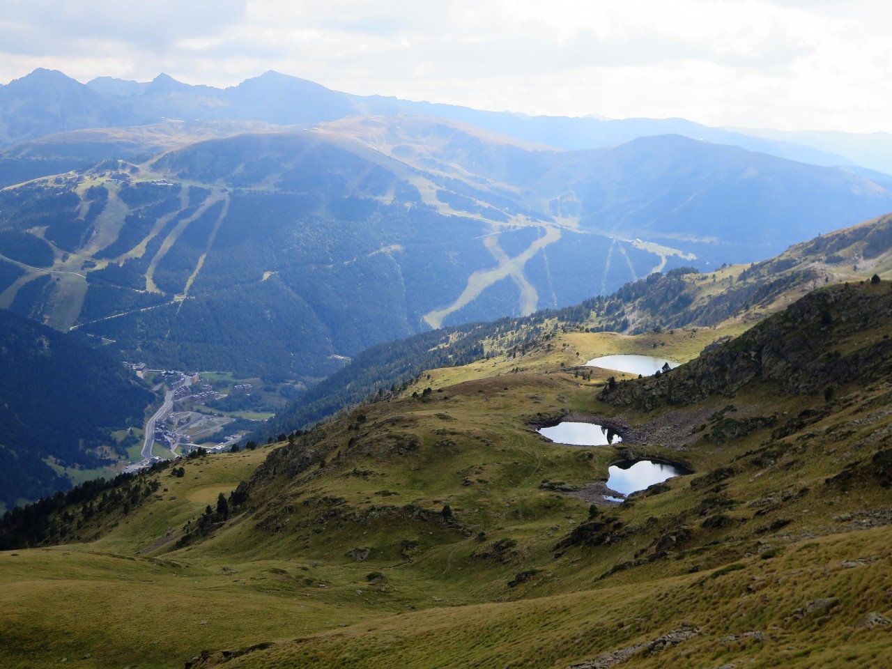
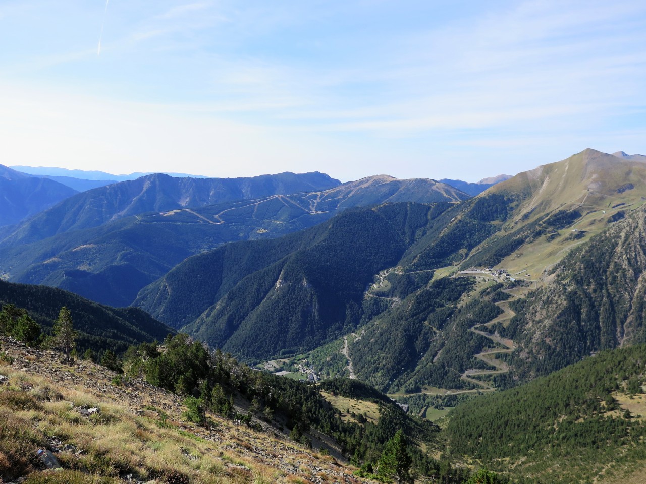
You can also see one of the big tourist attractions of Andorra namely the ski damaged terrain of Grau Roig. The descent down is very steep and we meet a couple of hikers coming up. For me descent is worse on the knees than going uphill. We pass by the many lakes in the valley. I have spotted a building marked restaurant on the map at the last lake, and we begin to talk about a beer and dinner there before setting up camp. Unfortunately, it is closed for the autumn, and will only open again when the ski season begins, so much for a cold beer.
Overlooking the route down the Estany (lakes) Pessons from the Pic Pessons
Instead we decide on hiking on to the next water source near the Refugi Pla des les Pedres. The hiking in the ski area is marred by the many slopes and lifts but the trail is easy to walk on. We have trouble finding a flat spot to sleep on, and there is a cold wind blowing, so we agree on sleeping in the small Refugi. It has a small terrace overlooking the Bordes d’Envalira area and the road into France, during the evening a low cloud cover come in and settles in the valley and on the peaks. Very near is also a ski lift, that for some strange reason makes siren noises during the night. Very annoying, we should have wild camped instead.

Clouds rolling in on the peaks and the Bordes D’Envalira seen from the porch of Refugi
Day three – Refugi Pla des les Pedres to wild camp just before Refugi De les coms de Jan – Total ascent 1400 meters.
The next morning, we make our way down to the buildup area of Bordes d’Envalira. We had been told that there would be the possibility of some small-scale shopping, but again everything is closed down. We do find a gas station and nearby café, where we enjoy a cup of coffee, and I buy a six pack of Snickers to supplement my dwindling supply of energy bars. I give two to Henrik. We continue up the road and find the markings of the GRP trail again. It climbs very steeply up towards the coire of Clots de Massat. Here we lose the trail and spend a little time looking for it, before we just head upwards hoping to spot it again. The map tells me, that we must gain and follow the ridgeline, before we descend into the grassy cairn of Port Dret at 2589 meters.

Looking into the valley from the slopes of Siscaro
As we reach the ridge, we spot the markings again before we head down in the large grassy cairn before crossing the slopes of Siscaro and descending the Valley D’Incles at 1800 meters. It is very hot in the valley, and we meet many day hikers and families going up the trail as we come down. We also meet our first Marmots, who are very common to the area. We also saw Eagles and Sarrios on the hike.

Marmot keeping a keen eye on us while we pass
After lunch at the parking area at the head of the Valley D’Incles, we again head up. The goal of today is to wild camp near the Refugi de Coms de Jan which lies in the next valley called Ransol. Between the two valleys lies the pass of Serra de Cabana Sorda at 2650 meters. I remember the advice of an old climbing instructor that once told me, that you can never go to slowly up a mountain. The hiking is very tough but the terrain opens and we get some very beautiful views of the surrounding areas.
On the way up the Cabana Sorda with look back on the Bordes D’Envalira and skiing area
Especially the last stage before gaining the pass is a hard grind on the body, but again I actually prefer the climb instead of the steep descent on the other side. We drop down the Coma de Ransol and come across a little lake with a nice flat area to camp on. There is a cold wind coming down the mountain, so I pitch my tarp closed on the wind side and sleep nice and warm after an exhausting day of going up and down.

Wild camp in the mountains with clouds rolling in. It gets cold so bring a toasty down jacket
Day four – wild camp to Refugi L’Angonella – Total ascent 1300 meters.
I start the day by looking at the map and planning out a rough sketch of today’s stage. It has become the rule that the GRP trail is either going up or down, it never goes in s straight line. Today there are two climbs and one long descent. Henrik is already moaning, so I neglect to tell him of the days last climb of about 800 meters, instead saying something vague about finding a camp spot in the valley before attempting the climb.
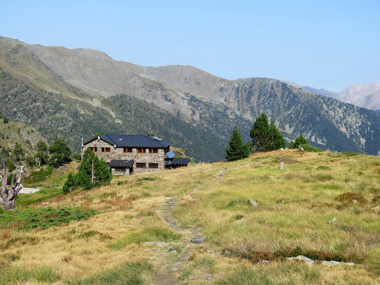
Coma de Ransol boulder field and scenic Refugi Coms de Jan
Anyway, we start the day by crossing the slopes Coma de Ransol before beginning the ascent to the Collada dels Meners at 2719 meters.

Blue skies greeted us on the way up to the Collada dels Meners
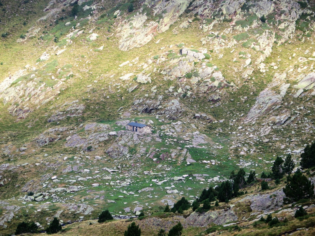
The area has been historically mined for iron. Just before the pass we find an old stone shelter probably used by shepherds or smugglers.

Smugglers hut just before the pass
After the pass, we hike down the long beautiful Sorteny Valley all the way to the small buildup area of El Serrat, at the bottom of the Valley. Along the way we pass the manned Refugi Borda de Sorteny, where they offer Wifi and beer, so we take a well-deserved break there before continuing on.

View down the Sorteny valley from the pass of Collada dels Meners
In El Serrat we cross the main road and follow the river south till the town of Llorts a nice easy hike on a wide path. In the town of Llorts, we find a small hotel bar that offers coffee and sandwiches which refuels us for the long early evening and grueling ascent from 1400 meters to the Refugi de L’Angonella at 2235 meters.

View of evening sun setting from the Refugi L’Angonella
Arriving at the Refugi we decide to sleep indoors in the small Refugi, and enjoy the setting sun from the small porch outside overlooking the Grand Valira Nord. During the night Henrik finds out that his sleeping pad has sprung a leak, which we must try to fix the next day.

Enjoying the views down the Valira Grande from where we came on day four
Day five – Refugi L’Angonella to wild camp at the foot of Pic Comapedrosa – Total ascent 900 meters.
During the night, I had awoken twice. Once when Henrik re inflated his sleeping pad, and once when I heard a horse whinny, so I was not surprised to see a small herd of horses, when I stuck my head out the Refugi the next morning. They were quietly grazing and drinking water from the nearby stream.
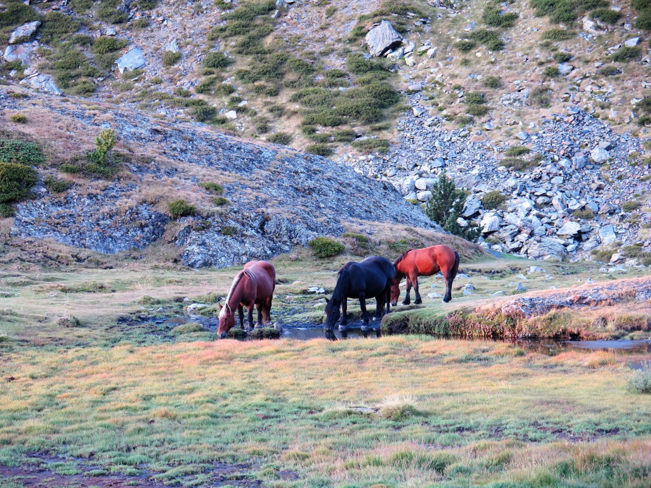
More or less wild horses grazing at 2300 meters altitude
All the Refugis we passed has had a water source close by, but bring a filter just in case you have to hydrate from questionable sources. The Refugi is on the side of the mountain, so we were still about 400 meters from the top and as we were preparing to leave.

Our ground shadows when ascending to the ridge
Two hikers arrived having done a morning ascent from Lllorts. We had already seen them the evening before, at the hotel with the bar. We all said bon dia and began the trek up towards the ridge, that would take us all over into the next valley. They were quicker than us in gaining the ridge even though they already had done the 800 meters to the Refugi from the bottom of the Valley in Llorts, but what is that worth, when you don’t know if the route is left or right on the ridge and you can’t find a marker. So, when we slowly and steadily gained the ridge they were still searching for a trail marker. I knew, from the map, that the trail went left on the ridge, and pointed them in that direction whilst waving my map. It amazes me that people will hike in mountainous terrain without a map, it is something I would never do and for this hike I had both a paper map and a topographic map downloaded on the Viewranger App on my phone. Better safe than sorry. I would still make a navigation error later this day and on the following day, but at least I could get back on track without needing someone to point me in the right direction.
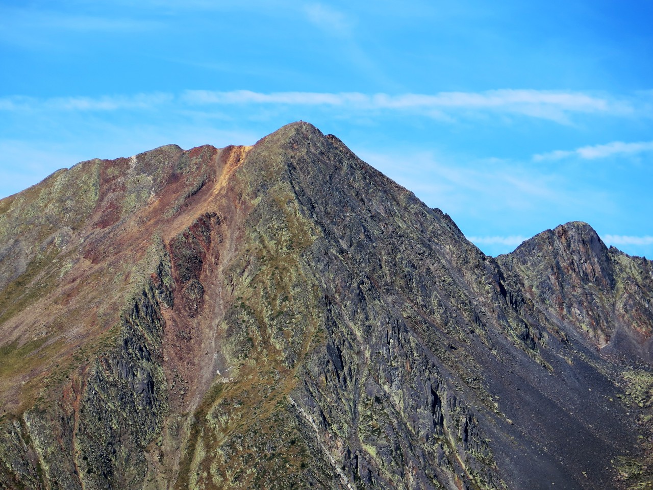
The highest mountain of Andorra The Pic Coma Pedrosa seen from the east ridge
We traversed the ridge and crossed over the Pic del Clot del Cavall before heading down and passing the Refugi de les Fonts where we took a short break looking down on the small town of Arinsal 800 meters below. After the Refugi that trail head into trees on the slopes of Coll Carnisser.
Arinsal valley from the Refugi Fonts and views into Spain in the distance
Here at one point and without me noticing the trail divides into two with the northern one disappearing into nothing but trees and rocks. Unfortunately, one branch pierced my Befree filter and water bottle as I scraped past, leaving me without a way to filter water for the rest of the hike. Henrik had his Sawyer filter with him, so we managed but still irritating even more so because it was ultimately caused by my own navigation error. After this accident, I realized that we were off track and that the trail had to be further below us. This left us with two choices, either backtrack along the route we had just come from and rejoin the trail where it divided or begin an off-trail descent on the slope. We opted for the last choice, which was not without some danger as we might come to an overhang where we would have to go back again. I didn’t take long for me to spot the trail below us and we were back on track without further problems that day.
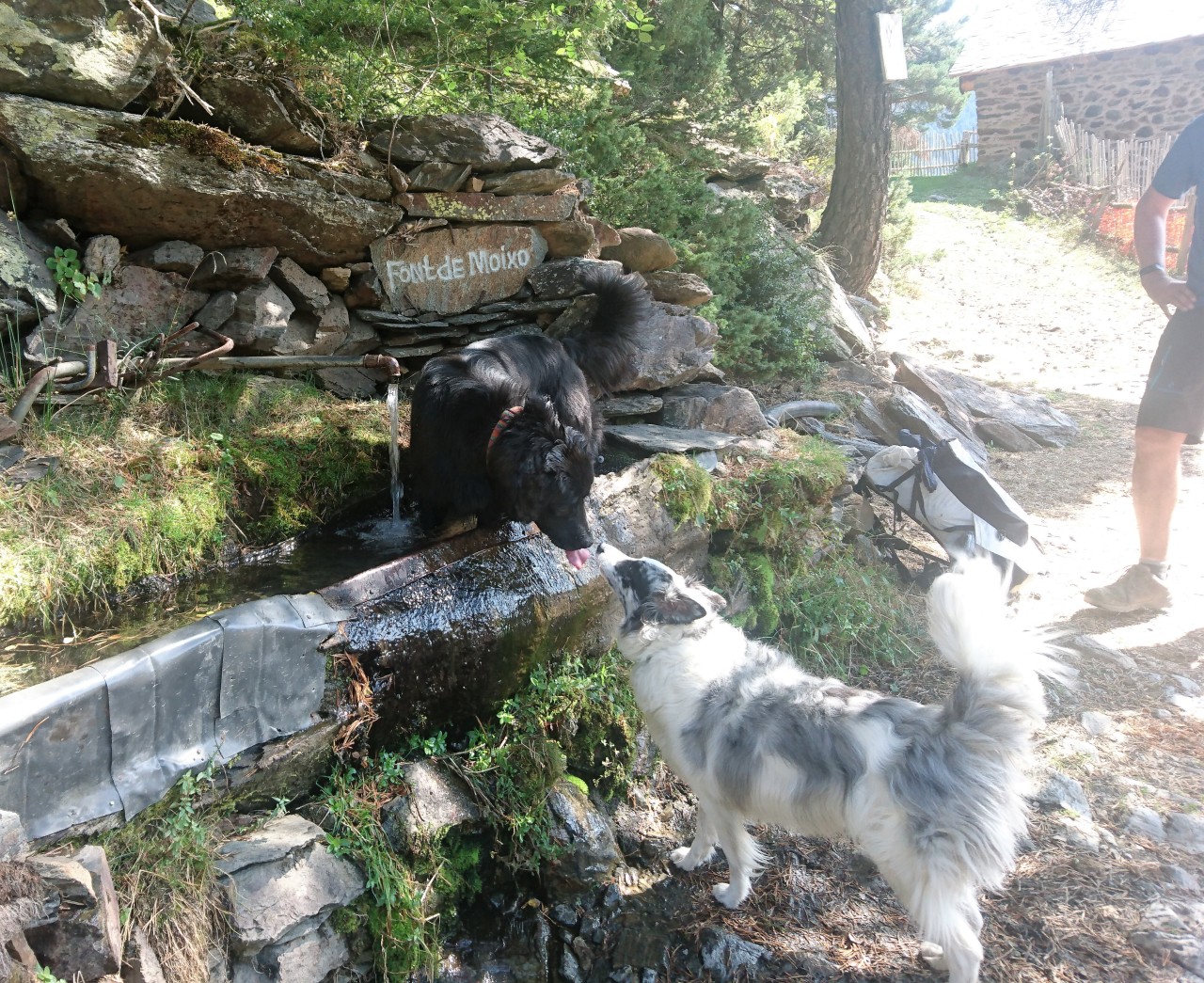
It was a warm day, and on the way down we met two furry friends taking a dip in the fountain
We continued down and entered the huge bowl with the Refugi Pla de L’Estany below the Pic de Coma Pedrosa. We passed the Refugi and again gained the trail leading us even further down to the main trail that would take us up again towards the Refugi de Coma Pedrosa, which is the impressively situated and manned hut closest to the highest mountain in Andorra, namely the Pic de Coma Pedrosa. The trail up winds its way between trees and streams until it gains the coire with the Refugi.
Refugi Coma Pedrosa
Here we stopped for a short meal and break. We also used the nearby lake to locate the hole in Henrik’s sleeping pad so he could fix that for the coming night. Late afternoon we hiked to the bottom of the Portetta de Sanfonts ridge and made camp.

My camp below the ridge line with the sun setting behind it
The weather had been sunny all day which would make for a very cold night without any cloud cover here at almost 2400 meters altitude. With the sun setting early behind the ridge we hit the sleeping bags early, and we had talked about getting up early and trying to hike up the ridge in the light from the full moon.
Day six – wild camp to Saint Julia de Loria and rented car – Total ascent 700 meters.
The night was very cold and Henrik borrowed my down jacket, as I had brought a warmer sleeping system than him. At 5.30 I called to him, that if he was awake, we might as well get going as we would get warm from the hike instead of lying here being cold. We started to pack and was away a little to six. We gained the ridge in the moonlight without any problems and could see the next peak in the distance. Here we missed the trail markers and began to go up the Pic de Port Negre. Immediately I thought something was wrong so I pulled out the map to check the route, but my damn eyes are not that good anymore in the dark and even by torch I had trouble making out the small symbols on the map. I had off course not brought my reading glasses for this hike but I will in the future. To err on the side of caution we went down again and backtracked to where we had lost the last marker, and from there we went on searching for a new one, which we found going down into the coire and not up the mountain.
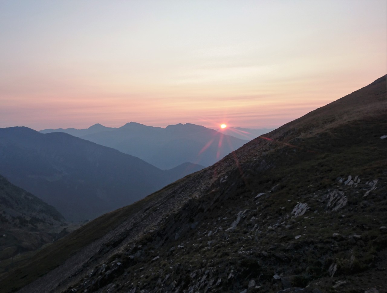
Sun rising in the east seen from breakfast spot on the last day
Being back on track we continued along the slopes of Serra Del Corrals before dropping down to Coll the la Botella. The trail continues along a rather boring ski terrain but the walking is pleasant and the view to the south are beautiful. The route continues to descend into the Coll de Montaner before the long hike down into Sispony begins. Here everything was closed. We therefore had to continue further down finding a gas station and a supermarket, where they were kind enough to call us a taxi to take us back to our rented car in the town of Saint Julia de Loria.
Passing from one valley into the next. The GRP never goes straight.
We restocked on sodas and snacks for the drive back to Barcelona. Instead of staying the night in Andorra and getting up early for the drive to Barcelona airport, we had decided on going straightaway to Barcelona and staying at a hotel close to the airport giving us a little more time before flying home. The good thing about last minute hotel bookings is that you can find really good hotels at a cheap price, so we stayed at a four star hotel overlooking the sea a little south of the airport. The next morning we flew home after a great hike.

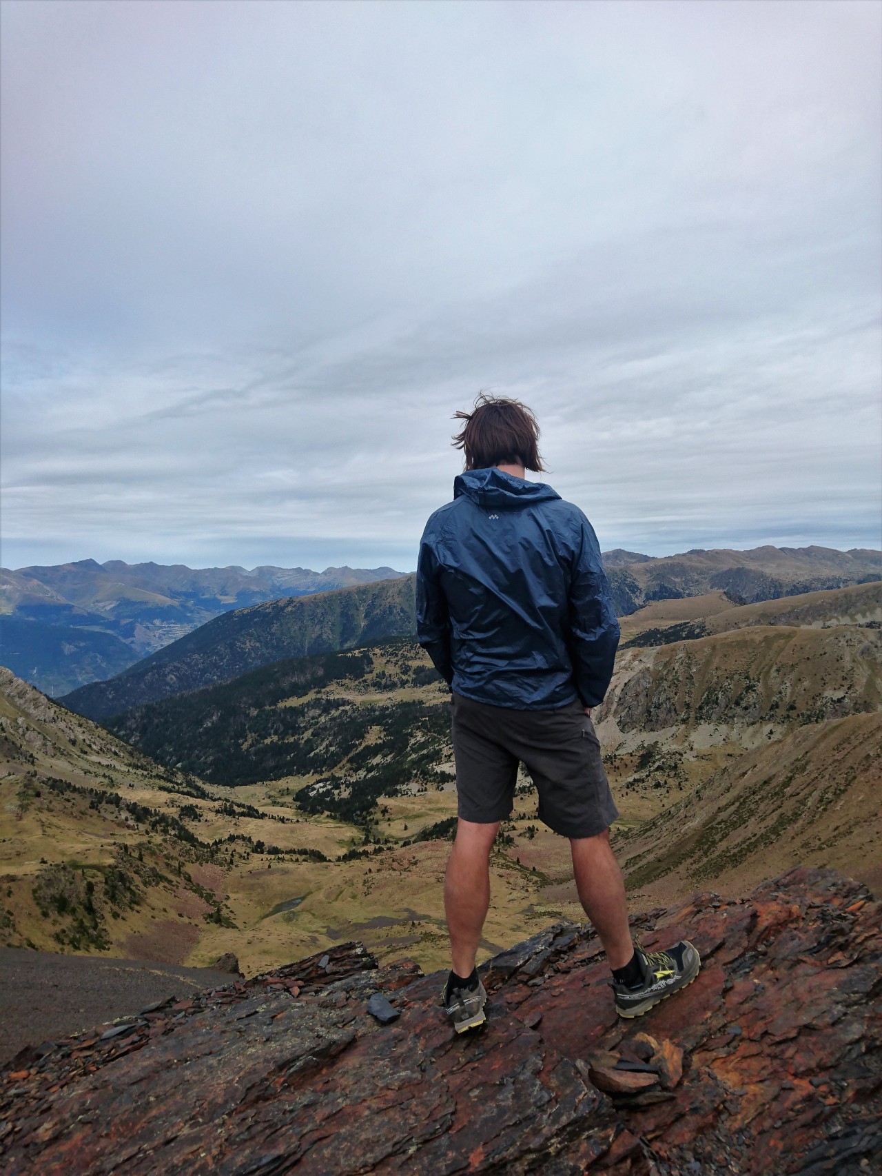
Me in typical hiking outfit
General remarks
I think, the Pyrenees mountains around Andorra are ideal for hiking. We experienced lots of remote and unspoilt terrain. The Refugis are simple but offer a perfect alternative to wild camping. All though I usually prefer wild camping, the two nights we spent in unmanned Refugis were nice. The GRP is well marked most of the way with red and yellow stripes. In some parts, the marking is the red and white of the GR routes instead, but if you bring a map (and reading glasses) you are good to go. The trail quality is usually good too. There were some very steep downhills that required care, so bring hiking poles. The route is up and down all the time, it very rarely goes straight, so lightweight gear is necessary. The weather in September was usually good, with the first part being slightly overcast and some rain during the first two nights. The it improved a lot with much sunshine but also colder nights. Bring sleeping gear rated to around 1-2 degrees Celsius if you plan to wild camp at altitude.
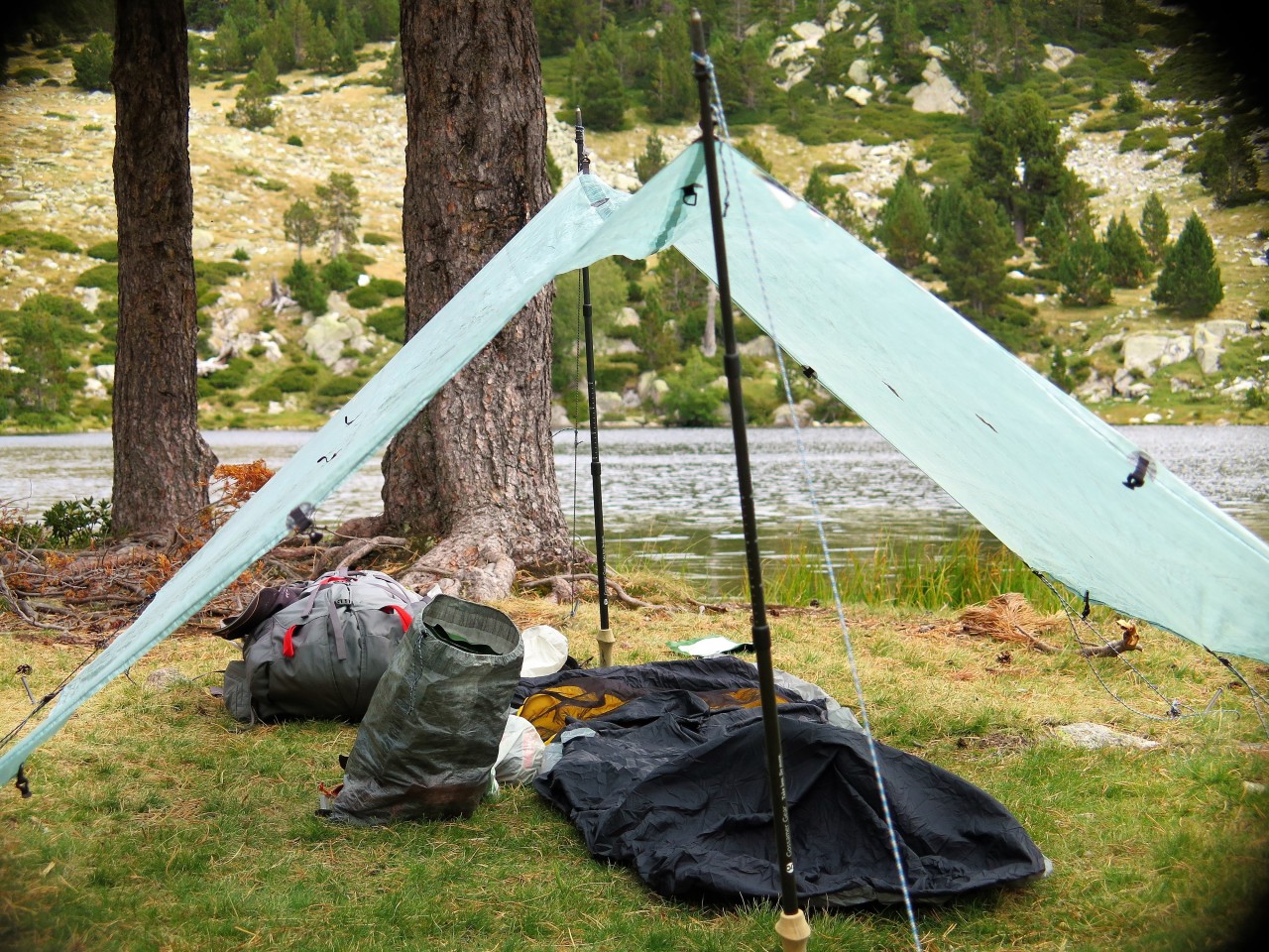
Typical camp setup on the hike
Gear List
| Gear list 6 days Pyrenees September | Gram | Name |
| Pack | 1125 | Sierra Designs |
| Tarp + Stakes | 432 | Hyperlite Mountain Gear + Ruta Locura |
| Pillow | 43 | Hyperlite Mountain Gear |
| Quilt | 699 | As Tucas |
| Sleeping mat | 392 | Sea To Summit |
| Sit pad | 120 | Omm |
| Bivi | 276 | Katabatic Gear |
| Alcohol cook set | 111 | Trail Designs |
| Alcohol bottle | 38 | Trail Designs |
| Foldable bottle 1,5 liter | 35 | Evernew |
| Water filter | 57 | Katadyn |
| Knife | 37 | Swiss Army |
| Spoon | 16 | Tibetan |
| Clothes in pack | ||
| Merino Beanie | 37 | Chocolate Fish |
| Down jacket | 212 | Luke’s Ultralite |
| Rain Quilt | 77 | ULA |
| Rain jacket | 216 | GoLite |
| Towel | 72 | Sea To Summit |
| Socks | 37 | Smartwool |
| Gloves | 59 | Defeet |
| Merino long pants | 166 | Aclima |
| Merino long jrsey | 198 | Aclima |
| Wind pants | 128 | Montane |
| Other stuff in pack | ||
| Torch | 86 | Petzl |
| Phone | 155 | Sony |
| Powerbank | 269 | Anker |
| Map | 75 | |
| Camera gear | 724 | Canon |
| Rep kit & First aid kit | 199 | |
| Saftey kit | 121 | |
| Hygiene kit | 110 | |
| Kindle E reader | 201 | Amazon |
| On the body | ||
| Sun Visor | 45 | GoLite |
| Bandanna | 14 | Buff |
| Merino short sleeve jersey | 139 | Aclima |
| Short pants | 222 | Patagonia |
| Wind jacket | 77 | Montbell |
| Merino underwear | 62 | Aclima |
| Trail runners | 720 | Altra |
| Watch | 84 | Garmin |
| Socks | 37 | Smartwool |
| Food and fuel | ||
| Alcohol for stove | 100 | |
| Food | 3282 | Mostly Real Turmat and Lyo Food |
| Base weight pack | 6523 | |
| Total weight pack | 9905 | |
| Skin out weight | 11305 |

Thanks for sharing Niels. I have seen a lot of marmots on PCT YouTube videos; I wasn’t aware that there were marmots down there too. What are your impressions of the Sierra Designs pack?
LikeLike
Thanks Brian. Your welcome. There are lots of Marmots, we also saw them last year in the Ordesa part of the Pyrenees. The Sierra pack is good. The flex part really works. I took it on a winter trip in February and expanded it, and it still carried weight well. It is at little on the heavy side, but it maintains a really good stability. The belt and pockets are nice, but I miss a little net on the outside to stuff windshirt into and so on, but maybe that is just habit, as I used the top lid for it on this trip, and it worked well enough, and also carried the trash. The desing is so that you get lumbar support and some ventilation on the back at the same time. The lumbar piece took some getting used to for me. It will be my pack for longer hikes in the coming years. For shorter hiking trips or packrafting, I would use another pack.
LikeLike
Hi, much appreciated blog, I am going with 2-3 friends in June next year and there is very little info out there. I may have missed it but can you let me know your daily distances and times so we can try and plan. Also what where costs like, ie taxis, beer and food? Finally, have you done the GR20? If so how would you compare it? I found the GR20 tough but we did double up some days.
Many thanks
Sam
LikeLike
Hi Sam, thanks for the comment and Merry Christmas. It is good hike. I enjoyed it very much. Beautiful scenery. I have not done the GR20, so I cannot compare. There is a lot of up and down, the trail rarely goes straight. The prices are European, as the area is a well known tourist spot both summer and winter. Go do it, I dont think you will regret it.
Best hiking
Niels
LikeLike
Hi! So useful, thank you so much.
I assume you were easily able to get beds in the refugis along the way without having to call in advance? Do you remember how much they cost? Are there places to stop for food through the day or are you mostly on your own for cooking?
I’m planning on doing the same hike alone, and as I am coming from a work trip won’t be able to bring all of my gear. Do you think this is doable without bringing cooking supplies, camping supplies and loads of food?
Thanks,
Anne
LikeLike
Hi Anne. We did the hike in September, and we only stayed two nights in the small umanned Refugis. We were alone both nights. Being out of season a lot of the small shops we passed were closed, but I guess you can hike out or get a lift to a larger town for resupply. Anything is possible, but the route we did I wouldn’t do without cooking and camping supplies. The large manned Refugis were of a high standard, so if you can plan on them, then I think your plan is possible. The hiking is great and so is the landscape.
Cheers
Niels
LikeLike
Hi Niels, I am planning to do the GRP as well in September this year, and also with my own tent etc. I was wondering, are there enough water tap points along the way, next to the ones in the refuges? All the best, Edo
LikeLike
Hi Edo
Water was rarely a problem. But I remember I used a filter most of the time, and i also had to carry a couple of liters at dry areas around the skiing areas. Have a good hike you will enjoy it.
LikeLike
Hi Niels, thanks very much, and I will take a waterfilter with me as well.
Looking forward to this hike!
Best, Edo
LikeLike
Hi!
Thanks a lot for sharing! It’s the most useful blog I found so far 🙂
I am also going to visit GRP in September this year. But the only concern I have is a technical difficulty. You have mentioned very steep downhills, is it possible that would you describe it a little bit more?
I have some experience with trails with chains etc. in Tatra Mountains in Poland, but I would like to be sure that I can handle it 🙂
All best! Łukasz.
LikeLike
Hi Lukasz,
When I did the trail 2 years ago, I found it VERY poorly marked and sometimes very dangerous. At one point I had to climb around a glacier of sorts because the trail was meant to go right through it. I actually ended my hike 2 days early after I encountered a massive blizzard in July, and 3 thunderstorms. Because it’s so poorly marked in places, I lost at least 45 minutes each day trying to get back on the trail. One of the guys running the cabins told me that the smaller day hikes that are part of the GRP are well marked but that there’s a reason there’s so little information about doing it online- because nobody does it for all these reasons.
I was alone, and am quite an experienced trekker, but the GRP was too much for me to handle. The bulk of the trail is lovely, but the parts that aren’t lovely are pretty rough. I’m happy to answer any other questions about my experience!
Anne
LikeLike
Hi Niels,
Thanks for all the info!
I’ve got one question:
Do you remember whether the route was marked in both ways? Or is it only possible to follow the route ‘counter clockwise’?
Mieke
LikeLike
Hi Mieke
It is marked both ways. Happy trails!
/Niels
LikeLike